Transcription of the booklet-
 Archeological Survey of India
Dharwad Circle, Dharwad

Mirjana (Lat 140-33' N and Log 740-26' E0 is a village on the north bank of river Aghanasini adjacent to the National Highway no. 17 and is 10kms. from Kumta. Towrads the west of this village is the Arabian sea and other sidea are surronded by hill ranges. It is a picturesque place on the west coast of Karnataka.
Mirjana is known as "Midge" in Kannada writings. This village has no refernec in early inscriptions. It is possible that it was the town of Mussuris, a well known port frequented by Roman merchants between 1st and 3rd centuries AD and also mentioned by Plini (C. 77 AD), Ptinger (C. 100 AD) and Periplus (C. 247 A.D.). The ancient Mussuris is same as the present day Mirjana according to Forbes (1784), Rennel (1784) and Roberson (1791). Between 3rd and 16th Century AD Mirjana was never a popular place. In about 17th century AD a fort was constructed here in which remains of a Shiva temple, a Mahishamardini sculpture and a few Memorial Stones are found.

The Fort
No reference to the construction of the fort is found. Yet it is known from the contemporary sources that Shareeff-Ul-Mulk (1608-1640 AD), ruling Ponda as the fuedatory of the Adil Shahi Sultan of Bijapur, got this fort constructed. Contemporary writings reveal that this fort which passed on to many hands of the rulers was an important port for overseas trade and commerce during the medieval period. This port built on the bank of river Aghanasini, played a dominantt role during the Vijayanagara perioBlack pepper, cinnamon and other forest produces were exported from this port and Arabian horses which was the mainstay of the Vijayanagara cavalry were imported, according to Dominigo Paes (C. 1520 AD) and De Barros (1580 AD). After the fall of Vijayanagara empire this fort successively went into the hands of the Bahamani Sultans, Adil Shahis of Bijapur, a small ruling family of Uttara Kannada region, the Portuguese, Hyder and Tippu and after the death of Tippu the British held this fort town.


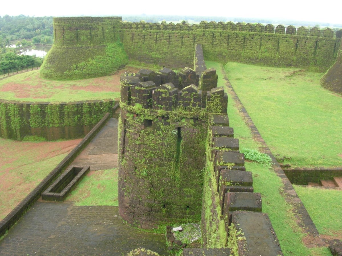
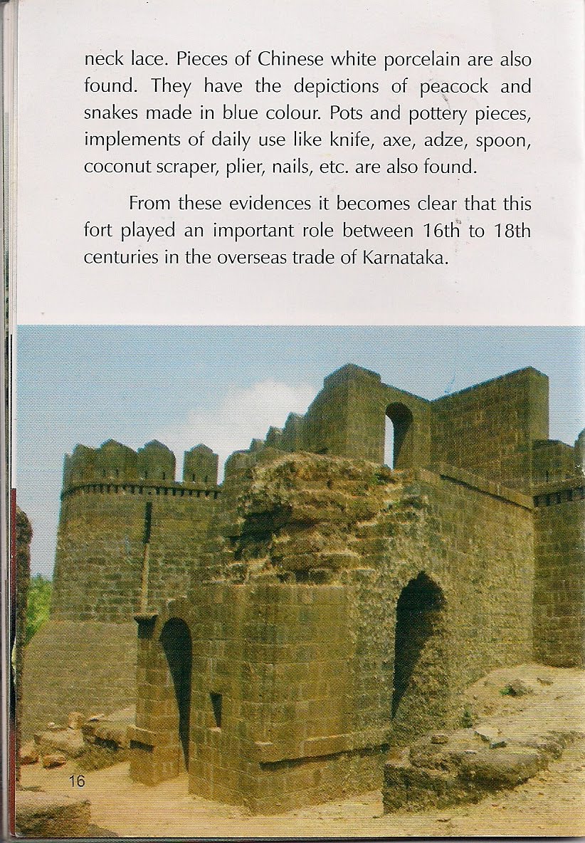
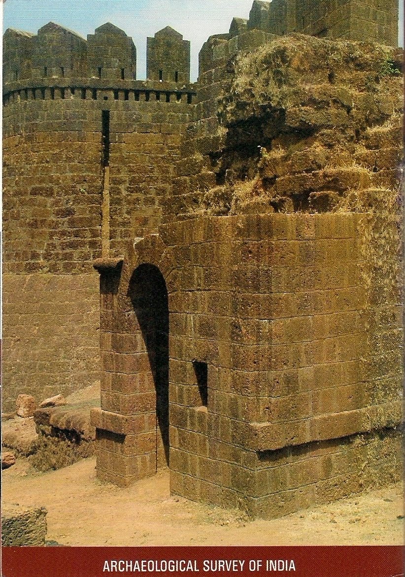
The fort spread in an area of 11.8 acres is built out of laterite blocks, octogonal over an elevated mound. The fort has four enterances of which the northern one is big and important too. the fort is surronded by a moat to which water is continously supplied by the nearby stream Kudurehalla. The walls built out of large dresses blocks is quite spacious and has eleven circular sloping bastions all-around. Above the walls are series of merlons and gun holes (100 holes) are provided in between. the top of the wall has a small path enough for a man to walk over. In front of the main enterance is a bridge (causeway0 over the moat that connects the gate and the land on the other side. This fort built using Islamic and Portuguese technology with best of the protective devices is one of the big and strong forts fo North Kannada district. All-round these portifications are found traces of underground passages but their clear network, at present, cannot be made out. There are three wells with stone lining dug inside of the fort.

Excavations
Mirjana Fort with its long historical importance has been declared as a protected monument. To trace the history of this fort and also to ascent its role in the social and economic ethos of its history the Archeological Survey of India, Dharwad Circle, conducted archeological excavations in the year 1999.

Excavations conducted inside the fort, over an area of 3900 square meters brought to light a huge structure built north-south and many other laterite structures and other remains. Of the structures excavated, the most important was the building built facing north. This measures 35 x 29.5 mts and it is in 'U' shape. Its east, west and southern sidea are surronded by other structures. the southern structure is taller than those on other sides. Large quantity of earthen tiles were found here and the post holes noticed lead us to conclude that this 'U' shaped structure had a tiled gable roof.
This structure was built to house the administrative offices. The chief of this, it appears had his assembly sitting at a high place on the south side with people assembled on the sides. A similar structure has also been discovered in the excavations at Hampi, the capital of Vijayanagara empire. Towards the south-west of this structure are rectangular buildings whereion during the course fo the excavation, charred black pepper, rice along with a saddle quern, iron pan, cocnut scraper are found. these allow us to conclude that this was the kitchen of those days.

Likewise towards the west of the 'U' shaped building at a adistance fo 16 meters is a nearly finished circular stone trough. The trough is plastered with lime mortar inside. Attached to the trough are disturbed masonry channels. Adjacent to these is a stone masonry soakpit. Water to these channels froma well found on the western side. At a short distance from these channels, towards the south, is a subterrenean chamber (5 x 5.3 mts in area) without the provision of steps. It is possible that this chamber was used to store explosives. From the evidence derived from these structures it becomes evident that this fort is a construction of 17th century and this fort played an important role in the maritime trade activities.

Methodical excavation conducted at the site revealed several antiquities. Important among these antiquities are the 75 cannon shot (balls). They have a diameter of 8.5 cms. and weigh 10 to 15 kg each. Other antiquities found are dumb-bells (5 nos.0, copper and lead coins, terracotta sealings, Chinese porcelain, copper rings, adze, axe, hammer, nails, etc.


Other important datable antiquities found in the excavations are 113 copper coins of hyder Ali's period. They have elephant on the observe and on the reverse legends in Arabic script, which is effaced and not possible to decipher. Terracotta sealing with Arabian and Persian languages written in Nastaliq characters read 'Rehman Khan Valad Gazi Fahim' in ornate characters. these sealings bear the date Hijira 1183 AD, which corresponds to AD 1769-70. From this sealing it appears that hyder Ali (1763-82 AD) had appointed Rehman Khan to look after Mirjana Fort.

Another important discovery is a gold coin dated 1652 AD minted in Goa by the Portugese. it weigs 3.79 gms., and has a diameter of 1.9 cms. the observe has image of St. Thomas. The figure in it's left hand holds a plough liek object. This coin was released by the Portuguese governer Conde De Sarzedes (Ad 1650-60). He was ruling from Goa during the reign of Monarch De jovo IV (AD 1640-56) as evidenced from the legend on the reverse of the coin. This coin contains a hook soldered on to its edge. This suggests that it was used as a pendent for a necklace.

Pieces of Chinese white porcelian are also found. Thay have the depictions of peacock and snakes made in blue color. Pots and pottery pieces, implements of daily use like knife, axe, adze, spoon, coconut scraper, plier, nails, etc. are also found.
From these evidences it becomes clear that this fort played an importabnt role between 16th and 18th centuries in the overseas trade of Karnataka.

ARCHEOLOGICAL SURVEY OF INDIA
.........
 Archeological Survey of India
Dharwad Circle, Dharwad

Mirjana (Lat 140-33' N and Log 740-26' E0 is a village on the north bank of river Aghanasini adjacent to the National Highway no. 17 and is 10kms. from Kumta. Towrads the west of this village is the Arabian sea and other sidea are surronded by hill ranges. It is a picturesque place on the west coast of Karnataka.
Mirjana is known as "Midge" in Kannada writings. This village has no refernec in early inscriptions. It is possible that it was the town of Mussuris, a well known port frequented by Roman merchants between 1st and 3rd centuries AD and also mentioned by Plini (C. 77 AD), Ptinger (C. 100 AD) and Periplus (C. 247 A.D.). The ancient Mussuris is same as the present day Mirjana according to Forbes (1784), Rennel (1784) and Roberson (1791). Between 3rd and 16th Century AD Mirjana was never a popular place. In about 17th century AD a fort was constructed here in which remains of a Shiva temple, a Mahishamardini sculpture and a few Memorial Stones are found.

The Fort
No reference to the construction of the fort is found. Yet it is known from the contemporary sources that Shareeff-Ul-Mulk (1608-1640 AD), ruling Ponda as the fuedatory of the Adil Shahi Sultan of Bijapur, got this fort constructed. Contemporary writings reveal that this fort which passed on to many hands of the rulers was an important port for overseas trade and commerce during the medieval period. This port built on the bank of river Aghanasini, played a dominantt role during the Vijayanagara perioBlack pepper, cinnamon and other forest produces were exported from this port and Arabian horses which was the mainstay of the Vijayanagara cavalry were imported, according to Dominigo Paes (C. 1520 AD) and De Barros (1580 AD). After the fall of Vijayanagara empire this fort successively went into the hands of the Bahamani Sultans, Adil Shahis of Bijapur, a small ruling family of Uttara Kannada region, the Portuguese, Hyder and Tippu and after the death of Tippu the British held this fort town.


The fort spread in an area of 11.8 acres is built out of laterite blocks, octogonal over an elevated mound. The fort has four enterances of which the northern one is big and important too. the fort is surronded by a moat to which water is continously supplied by the nearby stream Kudurehalla. The walls built out of large dresses blocks is quite spacious and has eleven circular sloping bastions all-around. Above the walls are series of merlons and gun holes (100 holes) are provided in between. the top of the wall has a small path enough for a man to walk over. In front of the main enterance is a bridge (causeway0 over the moat that connects the gate and the land on the other side. This fort built using Islamic and Portuguese technology with best of the protective devices is one of the big and strong forts fo North Kannada district. All-round these portifications are found traces of underground passages but their clear network, at present, cannot be made out. There are three wells with stone lining dug inside of the fort.

Excavations
Mirjana Fort with its long historical importance has been declared as a protected monument. To trace the history of this fort and also to ascent its role in the social and economic ethos of its history the Archeological Survey of India, Dharwad Circle, conducted archeological excavations in the year 1999.

Excavations conducted inside the fort, over an area of 3900 square meters brought to light a huge structure built north-south and many other laterite structures and other remains. Of the structures excavated, the most important was the building built facing north. This measures 35 x 29.5 mts and it is in 'U' shape. Its east, west and southern sidea are surronded by other structures. the southern structure is taller than those on other sides. Large quantity of earthen tiles were found here and the post holes noticed lead us to conclude that this 'U' shaped structure had a tiled gable roof.
This structure was built to house the administrative offices. The chief of this, it appears had his assembly sitting at a high place on the south side with people assembled on the sides. A similar structure has also been discovered in the excavations at Hampi, the capital of Vijayanagara empire. Towards the south-west of this structure are rectangular buildings whereion during the course fo the excavation, charred black pepper, rice along with a saddle quern, iron pan, cocnut scraper are found. these allow us to conclude that this was the kitchen of those days.

Likewise towards the west of the 'U' shaped building at a adistance fo 16 meters is a nearly finished circular stone trough. The trough is plastered with lime mortar inside. Attached to the trough are disturbed masonry channels. Adjacent to these is a stone masonry soakpit. Water to these channels froma well found on the western side. At a short distance from these channels, towards the south, is a subterrenean chamber (5 x 5.3 mts in area) without the provision of steps. It is possible that this chamber was used to store explosives. From the evidence derived from these structures it becomes evident that this fort is a construction of 17th century and this fort played an important role in the maritime trade activities.

Methodical excavation conducted at the site revealed several antiquities. Important among these antiquities are the 75 cannon shot (balls). They have a diameter of 8.5 cms. and weigh 10 to 15 kg each. Other antiquities found are dumb-bells (5 nos.0, copper and lead coins, terracotta sealings, Chinese porcelain, copper rings, adze, axe, hammer, nails, etc.


Other important datable antiquities found in the excavations are 113 copper coins of hyder Ali's period. They have elephant on the observe and on the reverse legends in Arabic script, which is effaced and not possible to decipher. Terracotta sealing with Arabian and Persian languages written in Nastaliq characters read 'Rehman Khan Valad Gazi Fahim' in ornate characters. these sealings bear the date Hijira 1183 AD, which corresponds to AD 1769-70. From this sealing it appears that hyder Ali (1763-82 AD) had appointed Rehman Khan to look after Mirjana Fort.

Another important discovery is a gold coin dated 1652 AD minted in Goa by the Portugese. it weigs 3.79 gms., and has a diameter of 1.9 cms. the observe has image of St. Thomas. The figure in it's left hand holds a plough liek object. This coin was released by the Portuguese governer Conde De Sarzedes (Ad 1650-60). He was ruling from Goa during the reign of Monarch De jovo IV (AD 1640-56) as evidenced from the legend on the reverse of the coin. This coin contains a hook soldered on to its edge. This suggests that it was used as a pendent for a necklace.
Pieces of Chinese white porcelian are also found. Thay have the depictions of peacock and snakes made in blue color. Pots and pottery pieces, implements of daily use like knife, axe, adze, spoon, coconut scraper, plier, nails, etc. are also found.
From these evidences it becomes clear that this fort played an importabnt role between 16th and 18th centuries in the overseas trade of Karnataka.
ARCHEOLOGICAL SURVEY OF INDIA
.........
Detail:
ASI booklet on Mirjan Fort