Raichur fort

December 23, 2012

We started our day with Manvi fort followed by Kallur, Maliabad fort, Sugureshwara temple at Devsuguur. Raichur fort was the last spot for the day. Lunch was at a Lingayath Khanawali and the owner Veerayya Swami was our friend now. I was glad to hear when he said he would like to join us for Raichur fort tour :-) This is the southern view of Raichur fort. A friend told me this hill is called as Gubber Betta. Cute name for a tough little hill. That stretch of water is Raichur lake.

This is a rough plan of Raichur fort with few details. Veerayya Swamy suggested we start the tour from point D, walk till Mecca Darwaza. As so say, you are our guide.


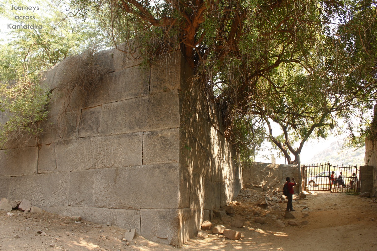
Looking towards Mecca Darwaza, Gubber Betta is on our left, concealed by a clump of trees. The pit to our right is the moat bed, now its overgrown with grass.

Beyond the moat are buildings which are not supposed to be there. The moat is about 40' wide. This is one of the largest bastions with a cannon. The stairway to the bastion has several sculptures of elephants, one of them is seen here (see inset).

Now we are at Mecca Darwaza, to  our right, out of sight. Within the fort premises is a KSRTC depot and bus-stand. Some time 2003, traveling from Hyderabad to Dharwad, I remember waiting for a bus here and looking up towards the fort ruins and wishing I could climb up. Well, the tome has come.. after almost 10 years!

Veerayya Swamy suggested we ride our cab from here to Takiwale Baba Dargah, we can climb the hill from there. From the base of the hill we are looking up towards the Dargah. A stairway cut out in the rocks. That's Veerayya Swamy. Three kids who happened to be hanging around agreed to be our guides.

That wall, close to the summit looks like a firing point.

 At this point I would like to quote two paras of the fort description found on Raichur disctrict website. The original fort at Raichur, according to a long inscription on a slab on the western wall, was built by one Raja Vitthala by order of Raja Gore Gangayya Raddivaru, minister of the Kakatiya queen Rudramma Devi, in the Shaka year 1216 (A.D. 1924). The walls of this fort are constructed of huge blocks of well-dressed and nicely fitted stones, without the aid of any cementing material whatever. The outer wall, which is constructed of comparatively rough stone masonry, however, is the work of the Muslims, as is shown by the various inscriptions in Arabic and Persian on its bastions and gateways. There are two gateways in the Hindu fortifications (Sailani Darwaza in the west and Sikandari Darwaza in the east) and five in the Muslim fortifications (Mecca in the west, Naurangi in the north, Kati in the east, Khandak in the south and Doddi in the south-west). The outer wall is enclosed by a deep moat on three sides, the fourth (or the southern) side being naturally defended by a row of three rocky hills, all fortified with massive ramparts. Inside the fort-walls, there are a number of old buildings and mosques of considerable archaeological interest, several of them containing inscriptions commemorating their erection during the later Bahmani and the Adil Shahi periods. The inscription referred to above is carved on a gigantic slab, about 42 feet in length, fitted in the western face of the Hindu defence. A number of drawings have been carved on this wall, at least one of which deserves a special mention here.

A little distance to the right of the above epigraph, is depicted the process by which the large inscribed slab was brought from the quarry to the site, laden on a solid-wheeled cart drawn by a long team of buffaloes with men driving and cudgelling the animals and applying levers at the wheels to push the cart forward. The artistic treatment in delineating the line of buffaloes in perspective, and the lively and graphic expression of the strain on them as represented by means of depicting some with tongues lolling out of their mouths, some with bent waists, and others with tails curled and lifted up as is usually seen when these animals are put to extra strain, is indeed a marvel of the art of drawing, particularly when the age of the work is taken into consideration. Further to the right is carved a procession scene of six chariots, drawn by humped bulls with decorative collars round their necks, and a little distance to the south is carved a forest scene with palmyra trees. On various other slabs in the same wall are incised floral and foliage designs as well as numerous figures of men engaged in various activities, and also animals and birds, like bulls, elephants, boars, jackals, cocks, peacocks, geese, etc., all executed in the same delightful manner. The bala hisar or citadel, situated on the middle and loftiest of the hills on the southern side, is approached partly by a flight of steps near the south-west corner of the Hindu wall and partly by a gradual slope which is by no means difficult of ascent. It stands on an irregularly shaped platform and contains mainly, a durbar hall, a small one-arched mosque in Bijapur style, a dargah called Panch Bibi Dargah and a square cistern now filled up with earth.

We start our climb at the base of this wall which is very close to the Dargah. The path was quite steep and narrow at parts. Our guides were like mountain goats, very nimble and fearless. Malatesh was lagging way behind.. shooting videos is a time consuming task.

Looking back toward the Dargah. These walls were constructed during Kakatiya rule.

Now were are half way up the hill. A water tank on our right and a vertical fall to our left. However, the view on the left is beautiful.
 
Raichur lake.
That's Mohan mama and Veerayya Swami. Our guides were hanging around some where close by, chatting noisily.

Down there is the Southern tip of the fort. Some where there is Khandak Darwaza, the southern gateway.

The path to the hill top goes around the hill counter-clockwise. This is the south-west part of the inner fort. Among those hills on the horizon is Maliabad fort. The summit is a minute's climb from here.

 
That's the summit and the 21' cannon pointing towards the south-west. On the dead-end of the cannon is an inscription in Persian (see inset).


The turret is damaged and the cannon is floored with its nose in dirt.


At the summit here is a small masonry structure which seems could be a summer house. Also there's a small mantapa which is an indication of a temple's existence here.

The interior might have been a grand sight long back but today its scarred and mutilated badly. On the northern wall of the building is a small window.

From the window our guides showed us this mutilated sculpture calling it aanee kaal meaning elephant legs. We told them it was Basavaanana kaal. Veerayya Swami actually went down there to inspect the ruins. With a sad expression he told us that Basavanna's head is lying down there. Those people have broken our Basavanna. He was genuinely hurt and asked us if there's a way to fix the head. Sadly, the answer is no :-(

Sun was setting quickly. Veerayya Swami suggested we move before it gets dark because this isn't a safe place after dark. We took a different way down which lead to a small gateway. That's Malatesh standing in the doorway. Close to the gateway on a rock was a geometric design (see inset).

Veerayya Swami suggested we visit Navarang Darwaza too. We planned it for the last day's morning of the trip and asked him to join us.

I have plans to come back here to see the sculpturing mentioned in the fort's description on district website. Seems like our friend is also not aware of it, otherwise he would have shown it.


Raichur fort coordinates: 16°12'8"N   77°21'2"E

.........

Goshaala at Maliabad fort

December 23, 2012

After Manvi fort we headed back towards Raichur with a stop at Kallur to see Mahalaxmi temple and the historic Markandeshwara temple. Kallur is also prehistoric site but we did not know what to look for. Next on our itinerary for the day was Maliabad fort, 6 kms south of Raichur. I wanted to check for a shortcut to Maliabad but a local man suggested we go via Raichur because the interior roads were in terrible condition. From Raichur 3 kms on Mantralaya we took the right fork which lead to Maliabad village. When we asked for directions to the fort, folks would ask if we wanted to go to the Goshaala..  OK, so there's a Goshaala inside Maliabad fort.

The fort is close to the village; we could see the wall with cotton fields in the foreground and Maliabad hill in the background.

As we move closer to the fort entrance the inner wall comes into view. In this picture below, the outer wall is marked in black and inner wall in white.

A narrow dirt track lead us into a gap in the ruined outer walls and continued little further with Maliabad hill on our left. The path ended with a locked gate between massive inner fort walls. A very narrow gap in the wall was the only way to get past the gate.

This 20' wall is made of just 5 layers of stone blocks, amazing isn't it? And the stones are dressed to perfection, smooth surface offers no grip to anyone attempting to scale the wall.

Makes me wonder how the sculptors managed to match the edges so closely. What we see is just the outer layer.. behind this is another layer and then packed rubble. These walls are solid enough to withstand cannon firing.. I feel cannon balls will bounce off these walls.

So this is a cattle enclosure.. we could see a herd of cows and calves. These are Javaari Aakala ~ Zebu breed. We guessed that this Goshalla protect and preserve Javaari Akala only, no hybrid varieties allowed here. In the background is an unfinished part of the wall. Abandoned stone-breaking activity can be seen (inset).

A partially dressed granite block measuring 5' x 5' x 10' was one of the smallest here. Larger ones approximately 18' long.

The herd seems to be eagerly waiting for the gates to open. This enclosure is L-shaped in plan, so its my guess this might be one of the entrances to the inner fort.

As soon as the gates parted the herd rushed off.. so this is their grazing time. This place looked peaceful, plenty of trees and shade. To the left we could see a small white building.. a man was waving at us, calling us towards him.

This person who called us lives here, away from his home in Rajasthan, managing the  operations of Go Rakshana Samiti. He is responsible for production of cow urine medicine. He tells us a bit about himself: He was a patient suffering from neurological disorder. His family spent huge amounts of money for medical treatment but his condition did not improve. Having lost hopes his family tried every possible medicine and some how they came across cow urine medicine. He believes he cow urine cured him. Now he wants to give a part of his life to help spread the benefits of cow urine. He showed us a booklet titles Cow Urine: Principles & Applications published by by Hare Krsna Rural Life. The booklet has a long list of diseases and conditions which can be cured or controlled by cow urine.

This reminds me of something when we had just moved to Bengaluru late 70s. Our house was situated in a new locality with few houses scattered around. Everyday few kids used to herd cows to graze in the vacant plots. One day I happened to see the kids collect handful of urine and drink ..I was zapped! I was ignorant of cow urine's medicinal properties. However, only the Javaari Aakala urine is considered beneficial, not the other breeds'.

Now we are at the distillery- earthen stoves, wood fuel, earthen pots of various shapes and sizes. The process seems simple but requires the right equipment and timing.

This seems like the pot which gives out the final product.

Earthen pots used for storage and wooden casks transporting to far away places. Right next to the distillery is one of the watch towers and in the background is the hill.

For retail market the medicine is packed in 250 ml plastic bottles- that made me wonder why use plastic to store an organic product? Low cost and safe to transport but the purpose of providing purely organic product gets defeated here.

Our host's living quarters is a single room arrangement. He cooks his own food and other basic needs. The blue text on the building reads: In memory of Late Madishetty Narasayya, donated by wife.

A lovely sculpture of Mahishamadhini found within the fort is placed close to the distillery.

We bid bye to our friend. It was almost noon, Sun was blazing fiercely. On the way our of the fort, Malatesh and I walked for some distance. We wished we had come here early morning, we could have explored the hill too. We found another L-shaped entrance in the inner fort. Here the granite blocks were larger than the ones we saw earlier. The top-most block is in excess of 20' in length. We realized there's a lot more to explore.. we have to plan another visit.

At the village we stopped at Hanuman temple to check out a row of hero stones. Two of them were  leaning on the front wall of the temple (inset).

A young man passing by stopped to inquire our interest in their monuments. His name is Srinivasa Murthy (see inset, right), a history teacher at government school here. He said he could have shown us an inscription on the hill. In the short meeting he told us this fort was built by Rani Rudramma of Warangal Kakatiya dynasty in 1296 CE. Later Maliabad fort became part of Vijayanagara empire during Krishnadevaraya's reign. Krishnamurthy seems to be a resourceful person.

He insisted we see the temple and a large Shiva Linga on the village outskirts, close to the fort wall. First we saw the temple, conditions around it is pathetic. Within the temple is an interesting hero-stone (see inset). Next we saw the 3' tall Shiva Linga made of black granite.

We noted Srinivasa's mobile number and promised to come back and explore the fort properly.

Here's a rough diagram showing the ruins of walls.


Maliabad fot coordinates:   16°8'59"N   77°21'26"E

.........

Mahalaxmi Devastana and Markandeshwara Gudi, Kallur

December 23, 2012

After Manvi fort, on the way to Raichur we decided to stop at Kallur. These hills are supposed to be prehistoric sites according to Raichur district website.

I'm quoting Kallur description here-

Kallur, in Manvi taluk, is a large village, about 13 miles from Raichur. The village is surrounded on all sides by granite hills except the east and derives its name from the abundance of the boulders on these hills. The village and the hills around are full of antiquities.

The present village, which is a modern growth, is surrounded by an old wall, which appears to be a work of the 13th or 14th century A.D. But the five gates appear to be of Muslim period. Two of them, which are not in much use, have no names. The other three are called after the towns to which they lead, Manvi Darwaza, Kalmala Darwaza and Raichur Darwaza. The gates are more or less in a ruined condition. The superstructure of the Raichur Darwaza, which has been pulled down to construct the chavadi in the village, contained a wooden inscription in Kannada. According to this inscription, which now forms part of the ceiling of the chavadi building, the gateway was constructed by Agha Khusru, a well known Adil Shahi dignitary.

There are six temples in and around the village. Out of these, only the Markandeshwara temple deserves some notice. This seems to be the oldest temple in the village and its hall has some pillars of black polished stone with beautiful carvings on them. A number of inscriptions have been found in this village, most of them belonging to the period of the Chalukyas of Kalyana.

Another interesting feature of Kallur is that there are many large and well-built wells. Five of these wells are very spacious, which have been built of solid masonry and have flights of steps leading to their base. It is not known when and by whom they were constructed. The largest well is 50 feet X 50 feet on the surface and about 120 feet deep and contains sweet water.

We navigated through the narrow streets of Kallur and reached Markandeshwar temple. From there Mahalaxmi temple is a minutes walk. It's a very small temple managed by a family. In fact the poojari's house is within the temple compound. We were allowed to photograph only the deity, the poojari asked us not to shoot pictures of the temple exterior.


This is the gateway to Markandeshwara Gudi.

That's the fort like gateway of this temple.

 The temple is built on a raised platform, situated at the base of one the three hills of Kallur.

Basavanna lying down in front of his lord.

Besides the temple is a Ganapti and a group of serpent sculptures.

Unlike other ancient temples this temple is not entirely made of stone, its a stone structure covered by brick and mortar. The structure's top has four minarets, one at each of the corners. The minarets are Islamic style, the design can be seen at Bijapur, Gulburga and Bidar in buildings built during Adil Shahi and Bahamani times. The temple has a 20+' high monolith pillar.

Outside the temple gateway is a small platform on which this Shiva Linga and Basavaan are installed.

We did not try to explore the gates nor the wells mentioned earlier. I was eager to reach Maliabad fort now.

A short video-


.........

Manvi fort

December 23, 2012

Manvi town is a taluka headquarter place. It is about 45 kms south-east of Raichur. Mani fort was the first place on our itinerary of the day. The fort is located one of the four or five hills of Manvi. After entering Manvi town limits, we spent 30 minutes to locate the base of the hill from where we could reach the fort. Locality close to the base of the hill range have narrow lanes, we had to leave the car nearly about half kilometer and walk it up to the hill. There it is- Manvi Kote.

Ravi and Mohan mama lead the way. Mama is right opposite the natural shelter which might have been used as a sentry post. The passage between the rocks is the fort entrance. 

Look of these walls reminds me of Irakalgad fort in Koppal district. The constructions styles are similar, builders have utilized the natural rock formations to their advantage.

Half way up the hill is the Dargah of a Muslim saint. On the tomb walls was painted a name which read as Gous Peer Rehmatullah Alai.
These two neighboring hills are on the west of Manvi fort hill. The small white patch on the closer hill could be Mallikarjuna temple.

This the uppermost and innermost part of the fort.

Close to the entrance is a rain water tank.
The tank is about 11' at the deepest point. Malatesh just entered the scene, he was lagging behind because he was shooting videos as he climbed.
Stone pegs driven into holes work as stoppers. This technique can be seen at few other forts such as Madhugiri and Huthridurga.

The uppermost fort is half open space and the other half is a mass of massive rocks. The highest point of the fort is a turret. Unfortunately the path to the turret was blocked by plants and I was no mood to wrestle with shrubs creeping with God knows what all creatures. In the picture below, to the extreme right is a vertical 40' fall.

In spite of near vertical rock faces a wall has been placed here. Perhaps, it covers a gap between the rocks and also it provides a platform for sentries.
The terrain is quite rough, ground surface is hard and loose pebbles make slopes dangerous.

We walk along the edge of the fort.. Mallikarjuna temple on the neighboring hill.

Down below is evidence of quarrying. On one of the rocks we saw a motif of concentric squares connected in the middle on all four sides.

Now we are the north-eastern corner. The corner most point has a small watch tower perched on a rock with vertical faces on 3 sides.

The structure is circular in plan with a narrow stairway to the roof which is about 14' in diameter.

Ravi and mama enjoy the commanding view of the town and the neighboring hills.

On the way down, I stop for a minute to take one last look at Manvi town.

We found a small restaurant right next to Manvi court premises. Breakfast was fresh idli/vade and tea. I happened to talk to local folks trying to find out about other historical monuments which might have got missed out in our plan. The men mentioned temples but I wasn't very keen in visiting temple because forts and prehistoric sites are my interest. Anyway, I thanked them and we left... Maliabad was next on our list.

I tried finding history of Manvi fort but very less was found. Here are few things-
* Mavi is home to Kalmath, Sri Chowdeshwari temple, Sri Mallikarjuna Swamy temples
* The other name for Gous Peer Rehmatullah Alai could be Hazarath  Sabjali Sattar Dargah.
* Manvi is the hometown of a great Madhva follower Sri Jagannatha Dasa, author of Harikathamruthasara


Manvi fort coordinates: 15°59'3"N   77°3'0"E
.........
Detail: Manvi fort
◄ Newer Post Older Post ►
eXTReMe Tracker
 

Copyright 2011 Journeys to temple is proudly powered by blogger.com